Weather forecasts for Panama suggest a mostly typical rainfall between May and July 2025, despite predictions of an unusually active Atlantic hurricane season. According to the Institute of Meteorology and Hydrology of Panama (IMHPA), rainfall across the country will remain close to normal, with slight variations depending on the region.
In the Pacific region, a minor increase in rainfall is expected, while parts of the Caribbean may experience a slight drop. IMHPA also anticipates weaker-than-usual trade winds and a relatively mild Indian Summer — a brief dry spell in the middle of the rainy season that might be barely noticeable this year.
The outlook was shared after IMHPA representatives participated in the 77th Central American Climate Forum, held in Guatemala. Experts from across the region came together to create a shared climate forecast, focusing on trends that could impact agriculture, water management, and disaster preparedness.
Mild Weather Shifts Expected Across Regions
A key element of the forecast was the current neutral status of a global weather pattern known for affecting rainfall and temperatures across many regions. International models show more than an 80% chance that this neutral phase will continue through July, helping stabilize weather patterns in Panama and other Central American countries.
Even though the Atlantic hurricane season is predicted to be busier than usual, with 17 named storms expected, experts say the risk of direct impact on Panama remains very low during this three-month period.
In terms of rainfall distribution, several provinces, including Chiriquí, northern and central Veraguas, Coclé, Herrera, Los Santos, Panamá Oeste, and Colón, could see a slight increase in rain, possibly up to 15% above the seasonal norm. This uptick is important for farmers and local officials managing water resources and flood prevention.
Meanwhile, other areas — such as southern Veraguas, Darién, Bocas del Toro, and indigenous regions like Ngäbe-Buglé and Guna Yala — are expected to experience rainfall that is slightly below average, by about 5% to 10%. These forecasts can help local communities prepare for possible changes in crop yields or water supply.
Rainy Season Arrives On Schedule
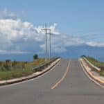
The start of Panama’s rainy season is progressing within expected timeframes. The western part of Chiriquí already began receiving regular rainfall in late March. Central and eastern regions, including parts of Veraguas, Coclé, and Darién, are projected to follow suit by late April through mid-May.
Wind conditions may shift slightly in July, bringing stronger breezes compared to May and June. This could increase both temperatures and humidity during the month. The brief mid-season dry spell, commonly known as Canícula, is forecast to occur locally between July 10–20 and again in early August. While rainfall may dip for up to 10 days during these periods, the effects are expected to be mild, with only slight increases in temperature and clearer skies.
IMHPA director Luz Graciela de Calzadilla highlighted that while the rainy season will likely stay within normal patterns, it is important to consider the aftermath of the previous wet season. She pointed out that heavy rains linked to a past weather phenomenon caused high soil moisture levels, particularly from eastern Coclé to Chiriquí. This lingering saturation could affect how new rainfall is absorbed in the coming months.
Engineer De Calzadilla emphasized that for the current forecast period, May through July, typical seasonal behavior is expected to continue across the country. She advised that while most conditions appear stable, regional differences in rainfall and brief dry periods like the Canícula should still be monitored closely to guide planning and preparedness efforts.